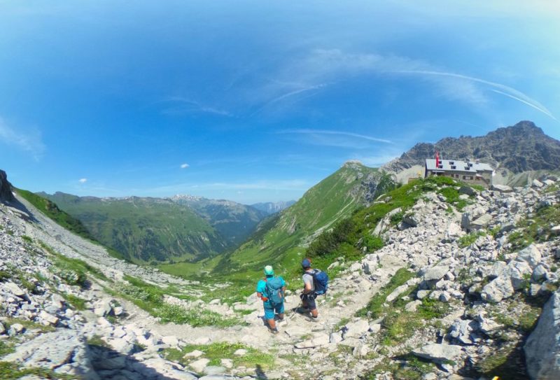
Bad Hindelang Tourism has now created a virtual hiking trail. It shows the six stages of the Grenzgänger Trail in the Swabian district of Oberallgäu. This leads 80 kilometres and 6,000 metres in altitude around the Hochvogel and is set to become a touring area by 2021.
The Grenzgänger is a multi-day tour in the heart of the Allgäu Alps. The centrepiece is the continuous crossing of the Austrian and German border between Tannheimer Tal, Hintersteiner Tal and Lechtal. The Bad Hindelanger tourist board has now made it possible to experience a stage hiking trail with dynamic images throughout. With almost 100 full-spherical images, the hiking trail is now digitally accessible. The recording team spent a total of 13 days on the Grenzgänger trail and walked over 120 kilometres. The result: a three-dimensional long-distance hiking trail with six gigabytes of data volume.
"The virtual reality tour is ideal for the cold season, when there is a thick blanket of snow on the hiking trails above," says Thilo Kreier, Grenzgänger project manager at Bad Hindelang Tourismus. The virtual border crosser hiking tour was technically realised by the AllgäuPix team from Sonthofen.
"The 225 full-spherical images were produced last summer. Assembled into almost 100 all-round panoramas, they now create a very vivid image for the six stages and take digital border crossers with VR glasses and smartphones on an extremely comfortable hike," explains Björn Ahrndt from AllgäuPix.
The team took the 360-degree images at the start and crossing points of the trail as well as at passages on the Lärchwand, at the Bockkarscharte or in the Kalten Winkel below the Hochvogel.
Click here for the virtual hiking trail: https://www.grenzgaenger-wandern.com/_images/360/Grenzganger%20VR.html
Source: all-in.de / badhindelang


