

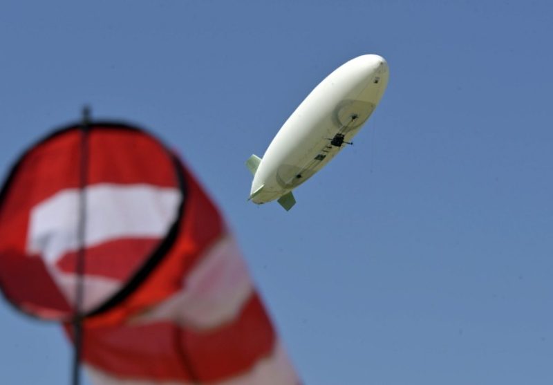
The Airbus Group is testing a new, unmanned airship above and in Aying, which will be used to map the landscape in three dimensions from July onwards. This will then be used to create 3D models of the location, which can be used to produce detailed virtual reality visualisations.
Seit Mitte Mai bietet sich im Süddeutschen Ort Ayingen ein immer wiederkehrendes Schauspiel. Ein elf Meter langes Luftschiff, das seelenruhig und lautlos über der Gemeinde seine Bahnen zieht. Von Juli an werde dann aus den jetztigen „Testflügen“ eine „Mission“, sagt Projektleiter Holde Ideengeber , dann beginnen die tatsächlichen Kartografierungen Ayings, welche dann für 3-D-Modelle in der VR genutzt werden.
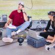
Die „Operation Crew“ besteht aus acht Experten der Luft- und Raumfahrt, die eine Alternative zu Drohnen entwickeln wollen. „Und wir haben dabei starke Argumente“, sagt Holder. „Luftschiffe sind im Gegensatz zu Drohnen supersicher, mit einem Niedrigrisiko in Hochrisikogebieten, und sie sind natürlich deutlich leiser.“
Moving the hangar on an articulated lorry
Bevor es an die Erstellung derart detailgetreuer 3-D-Modelle des Ayinger Ortsgebietes geht, steht für das Airbus-Team aber im Vordergrund, die Flugeigenschaften des Flugschiffs zu perfektionieren. Die Infrastruktur, die die acht Experten dafür brauchen, steht ihnen direkt am Sportplatz zur Verfügung. Dort haben sie ihren Hangar geparkt, einen Lkw-Container, in dem das Luftschiff „flugfertig“ verstaut werden kann und vor Wettereinflüssen geschützt ist. Wenn in nicht allzu ferner Zukunft eine andere „Mission“ an einem anderen Ort ansteht, werde der Hangar einfach auf einen Sattelschlepper verladen und an den Einsatzort gefahren.
Die Idee selbst sei in Friedrichshafen geboren worden, sagt Holder. Er selbst war dort längere Zeit tätig, in der „Stadt der Luftschiffe“. „Dort gehören Luftschiffe wie selbstverständlich zum Stadtbild und lösen auch Begeisterung aus“, sagt er. Ihm und seinem Team gehe es jetzt darum, „die Idee der althergebrachten, sicheren Technologie mit moderner Technik zu kombinieren“.
Detailed models in VR for a wide range of purposes
Die Gemeinde, sagt der Projektleiter, dürfe sich auf „eine schöne Darstellung ihres Ortes freuen“. Die 3-D-Modelle könnten als Methode dienen, sich mit einem „Alleinstellungsmerkmal“ darzustellen, etwa beim Thema Tourismus“, sagt er. „Gerade im schönen Alpenvorland.“ Das sei aber nur ein Aspekt, macht Holder deutlich. Mit den detailgetreuen Modellen von innerstädtischen Bebauungen können auch Strassenschäden identifiziert werden, Potenziale für Solaranlagen ermittelt und städtebauliche Massnahmen unterstützt werden, etwa beim Thema Denkmalschutz.
Ein prominentes Beispiel für eine mögliche Anwendung, sagt Holder, sei die Kathedrale Notre-Dame de Paris, die im April durch einen Brand massive Schäden erlitten hat. „Mit so einem 3-D-Modell könnten wir zeigen, wie Details ausgesehen haben, und dies für einen Wiederaufbau verwenden. Das hätte einen wahnsinnigen Wert“, sagt er. Aying ist nur der Anfang, später sollen vor allem grosse Städte kartografiert werden.
Source: sueddeutsche